Syllabus
Outcome: investigate differences in urban settlement patterns between Australia and another country, for example:
Where are the World's Cities most concentrated?
The image above is a satellite picture of the Earth at night. Images like this one can help geographers identify the degree to which urbanisation has taken place in different regions around the world. Some regions of the world demonstrate very little lighting indicating that urbanisation is limited, while others show clusters of lighting giving us clues to the parts of the world that have a higher degree of urbanisation taking place.
Urban Settlement Patterns
|
Concentric Zone Model
Sector Zone Model
|
Urban settlement patterns refer to the ways in which cities and towns are organised and distributed across a landscape. In general, urban settlement patterns are shaped by a range of factors, including physical geography, historical development, economic activity, and social and cultural factors.
One common pattern of urban settlement is the concentric zone model, which suggests that cities develop in a series of concentric rings or zones, with the central business district at the center and residential areas radiating outwards. Another model is the sector model, which suggests that cities develop along transportation corridors or other economic axes, resulting in distinct sectors or zones of different land use and socioeconomic status. In recent decades, there has been increasing attention to the concept of urban sprawl, which refers to the expansion of urban areas into surrounding rural or undeveloped land. Urban sprawl can have negative impacts on the environment, public health, and social equity, and there have been efforts to promote more compact, sustainable forms of urban development. |

👉
|
Complete the Guided notes in the google doc attached. Students will need to read the text above and watch the videos to complete their guided notes. 👉
|
|
Urban Settlement Patterns in Australia
Questions
- Create a table with three columns. Put headings at the top of each column. Your heading for the left-hand column should read ‘Least density’, the heading for the middle column should read ‘Medium density’ and the heading for the right hand column should read ‘Highest density’. With the use of an atlas or a political world map from the Internet, place 10 countries/regions into each of your three columns. Use direction to be as accurate as you can about where exactly in a country you are referring to as being the most densely populated places within the country. For example, for Australia you might indicate that urbanisation has a high concentration onn ‘The Eastern Coast of Australia’. Use the black link below to help you.
- Name three regions or countries of the world that have the most concentrated urbanisation.
- Name three regions or countries of the world that have the least concentrated urbanisation.
- Attempt to account for your response to questions 2 and 3. ie Why people are living in densely populated locations.
- Refer to the 'Global Rainfall Map' below. In 1 paragraph, describe the link between rainfall and the location of urban regions. Use place names, direction and latitude in your response.
Urbanisation on a Massive Scale
Source 1: The extent of Human Reach
What are the features of a Megacity?
|
A Megacity is a continuous urban area that has a population of over 10 million people. There are currently 34 megacities in the world. It is predicted that by 2030 there will be 41 megacities in the world. It is estimated that over half of the future growth in megacities will be within Asia. Mega cities consume 80% of the world’s energy and produce 80% of the world’s a greenhouse gas emissions. This leads to climate change and it is expected that slums in megacities will be most vulnerable to the impacts of climate change.
|
Source 2: Features of a Megacity
|
Worksheet Instructions
Below is a link that lists the largest cities in the world. You are to choose five mega cities(those with a population of over 10 million). For each city, fill in the table that can be found in the document below. Open it and begin filling it in.
https://en.wikipedia.org/wiki/List_of_largest_cities
Worksheet Link
https://en.wikipedia.org/wiki/List_of_largest_cities
Worksheet Link
The Influence of Climate on Urban Concentrations
|
The influence of climate on urban development is an important factor in determining the size, frequency and location of cities. When we refer to climate, we are ultimately focusing on precipitation and temperature. Large concentrations of urban regions rely on access to basic needs for survival, one of which is water. Large, densely populated cities require significant amounts of water for residential, industrial and local agricultural use. Accessing this large volume of fresh water requires precipitation in the form of either snow or rain.
|
Source 3: Physical factors that affect settlement
|
This means that precipitation is an important factor in determining where and how many cities can exist in any given region on earth. The video below explains a range of factors that can affect the amount of rainfall that any given location receives, thereby determining how many people can live their.The map below shows precipitation amounts in inches. The darker green regions represent places that receive a lot of rainfall while the yellow regions represent dry regions where there is a distinct lack of water.
Questions
- What are the basic needs of survival?
- Which sectors of the community use water?
- Outline the link between rainfall and urban concentrations.
- Outline the link between temperature and urban concentrations. Hint: View the video below.
|
Temperature is also a factor that determines the location, size and frequency of urban regions, although not to the same extent as precipitation. Temperature influences urban regions in parts of the world that are extremely cold or hot. Life is very difficult for those areas that have extreme temps. Antarctica is one such example.
|

Source 5: Video showing climate of Antarctica
|
Questions
- Describe the living conditions in Antarctica.
- Outline some of the challenges you think would be faced by people living in Antarctica.
- How have communities overcome these challenges?
The Influence of Topography on Urban Concentrations
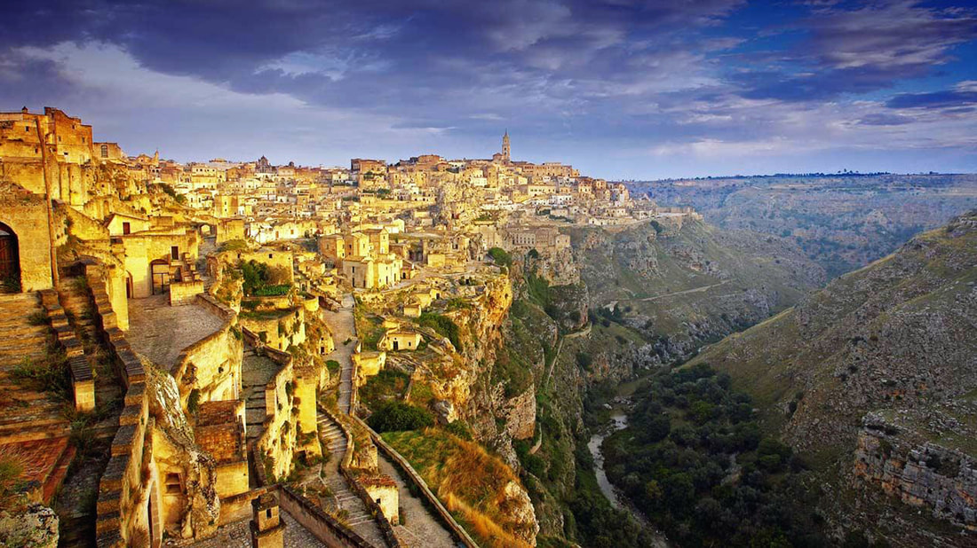
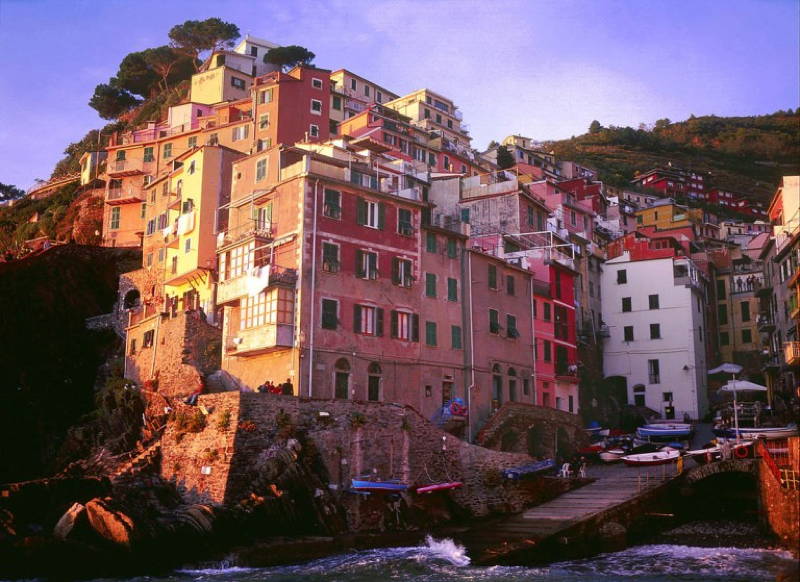
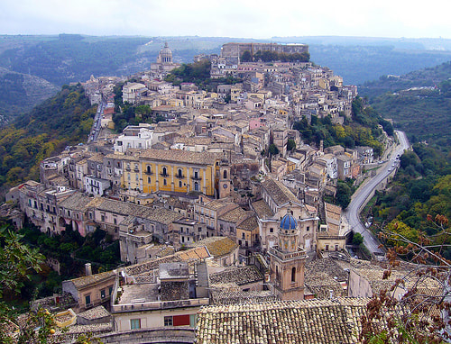
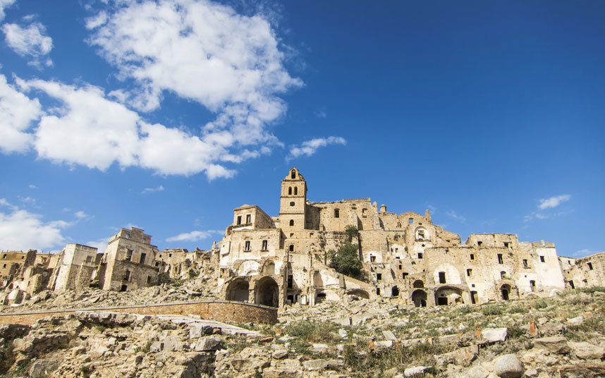
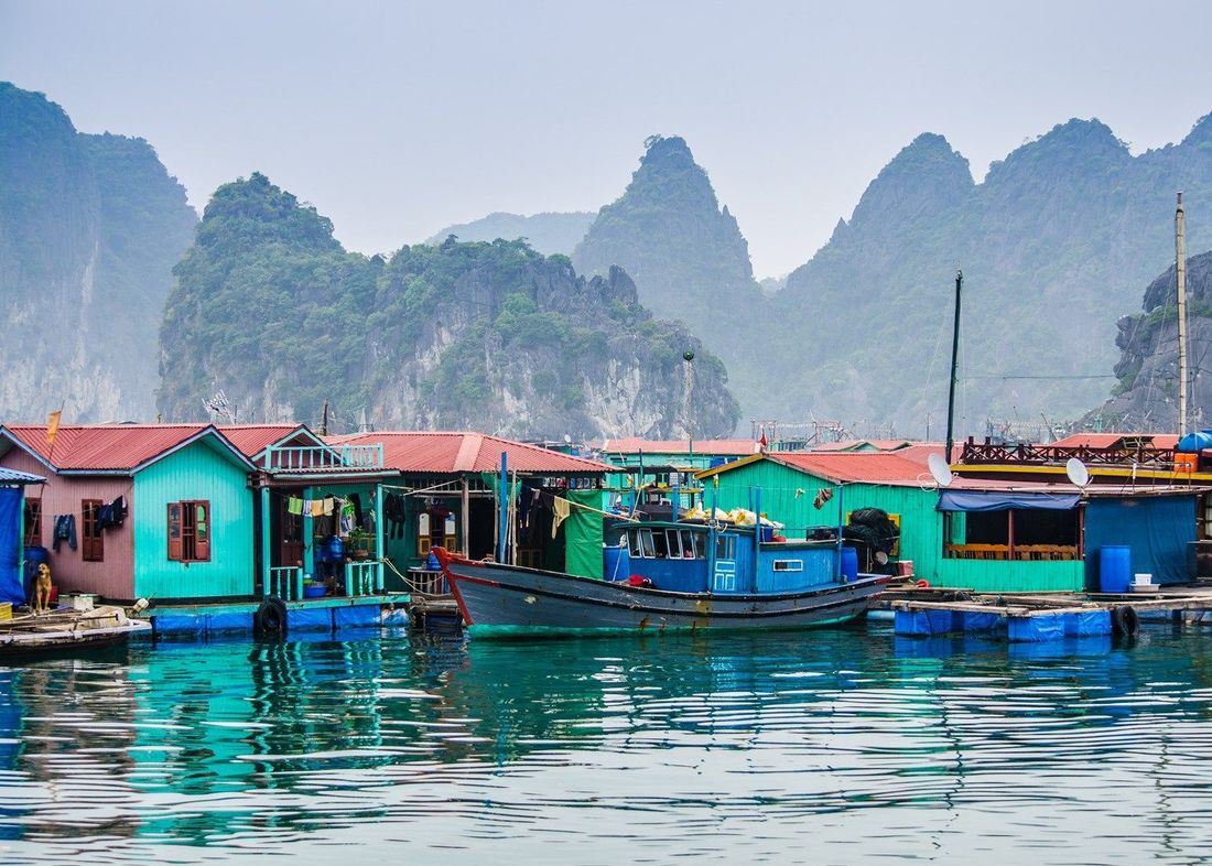
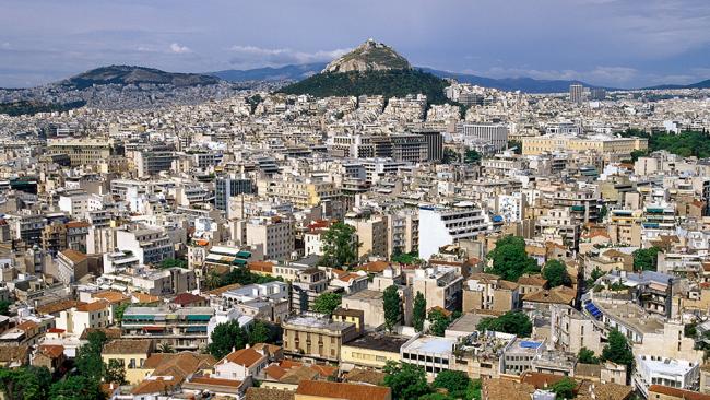
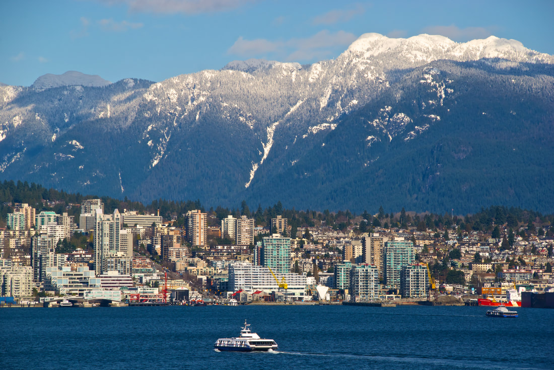
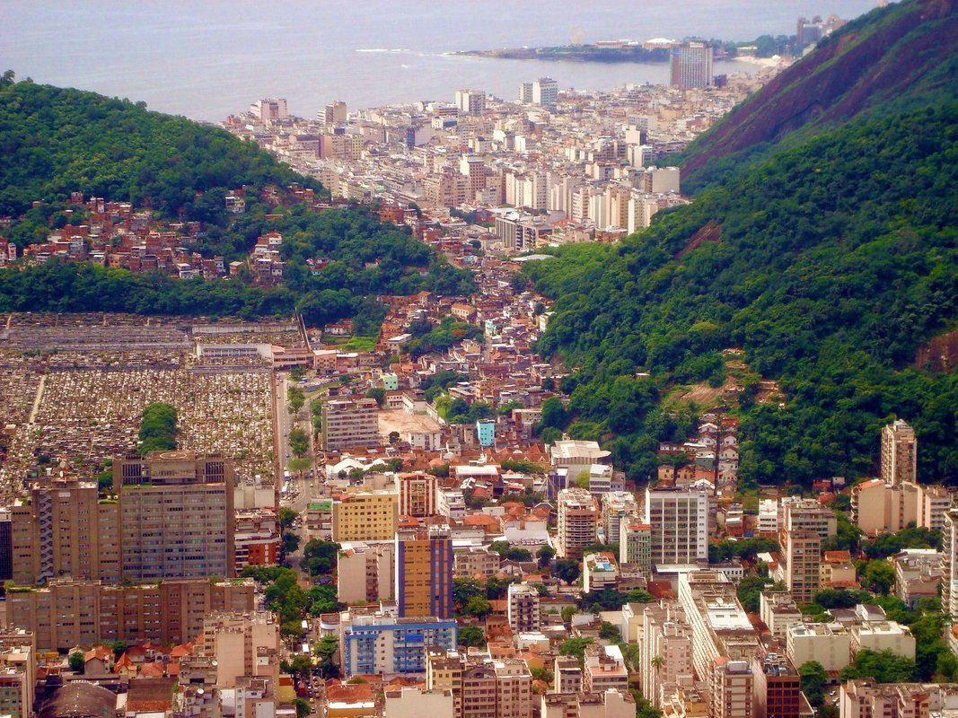
In addition to climate, population distribution and concentration is often defined by the shape of the land. The images above demonstrate how topography can influence the location of urban regions. Generally speaking, urban regions require flat or gentle sloping land. However, this is not always the case. Rio De Janeiro has a large proportion of its urban region on steep gradients. Generally, urban regions are not built on steep slopes where flat or gently undulating land is limited. Similarly, urban regions tend to be limited in mountainous regions. They are often steep and do not supply large volumes of water. They are also usually colder and therefore less attractive as a place to live.
China's urbanisataion
|
Almost half of all of China’s gross domestic product (GDP) comes from its 30 largest cities. These cities contain a growing middle-class who’s spending is generating enormous growth. Shenzhen, Shanghai and other cities in the east, provide jobs with the highest incomes which explains why China’s migrant worker movements are highest to these regions and why they have a population growth rate of 12% a year.
China’s incredible growth of urbanisation has resulted in a massive push for new developments in these cities with the construction industry accounting for 20 to 30% of gross domestic product, employing approximately 50 million workers and consuming nearly half of the worlds steel and cement. There are so many cranes in Chinese cities that they have become a part of the cityscape. The construction of residential and commercial towers, shopping malls, roads, railways and factories is causing unprecedented urban sprawl much like a spreading pancake in a frypan. Chinese new high-density suburbs and central business districts are very different to the low density urban sprawl Australian cities. Chinese cities are packed full of high-rise towers often referred to as cookie cutters. Much of the low density housing in Shanghai is being demolished to make way for urban renewal projects with significantly increased population density thanks to high-rise buildings. New cities such as chain gong in Yunnan province alright an excellent example of the increasing number of ghost cities found in China. |
|
|
Source: arcg.is/OWnW1
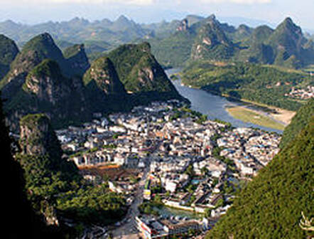
Source 6: Yangshuo is a town cramed into a small space.
|
Comparing the USA and Australia
|
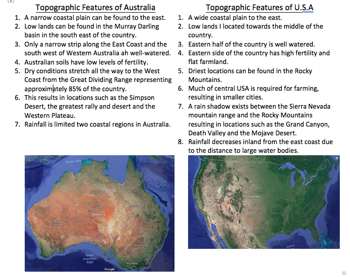
To the right, topographical features are listed for Australia and the United States of America. Read them and then answer the following question in your book.
Questions
|
|
The Influence of Transport Networks on Urban Concentrations
Life in Africa's slums- Kibera
Dharavi
Watch the following two episodes and make notes as you watch.
Read and summarise the following article:
Extension:
You are to respond to the following question:
What should happen to Dharavi? Should it be demolished and rebuilt or left alone? Provide reasons to support your answer.
You are to respond to the following question:
What should happen to Dharavi? Should it be demolished and rebuilt or left alone? Provide reasons to support your answer.
